GEOSTEERING DRILLING PERFORMANCE SOFTWARE

Target Pay Zones with Depth-Based Data and Geologic Datasets

Set your team up for success with subsurface depth-based data, drilling analytics by formation, and integrated geologic datasets to accurately guide the bit through the most effective zones, extend equipment life, and maximize production in the drilling window.

MAXIMIZE RETURN ON DATA DEPLOYED

Powering Drilling with Subsurface Insights

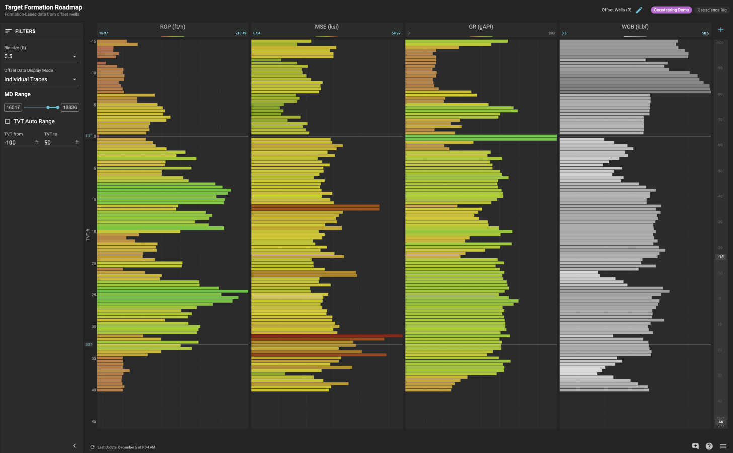
Bring depth-based data streams, offset wells, and historical data into your drilling workflows, including WITSML measurement and logging while drilling, WITSML time converted to depth, and wireline logs. In turn, your drilling team can adapt on the fly to updated formation tops to optimize ROP and minimize premature bit wear.

Equip your entire team with powerful well log visualizations, analysis, and collaboration capabilities either in real-time or on a historical basis. Depth-indexed data including logging while drilling (LWD), mud logs, downhole drilling dynamics, and surface drilling parameters can all be displayed together in customized views.
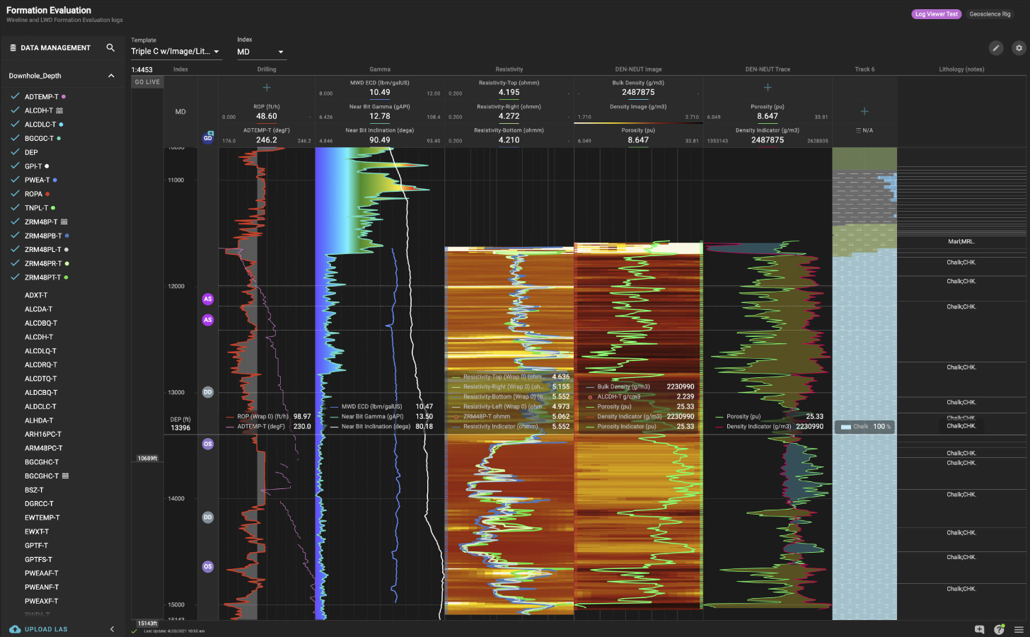
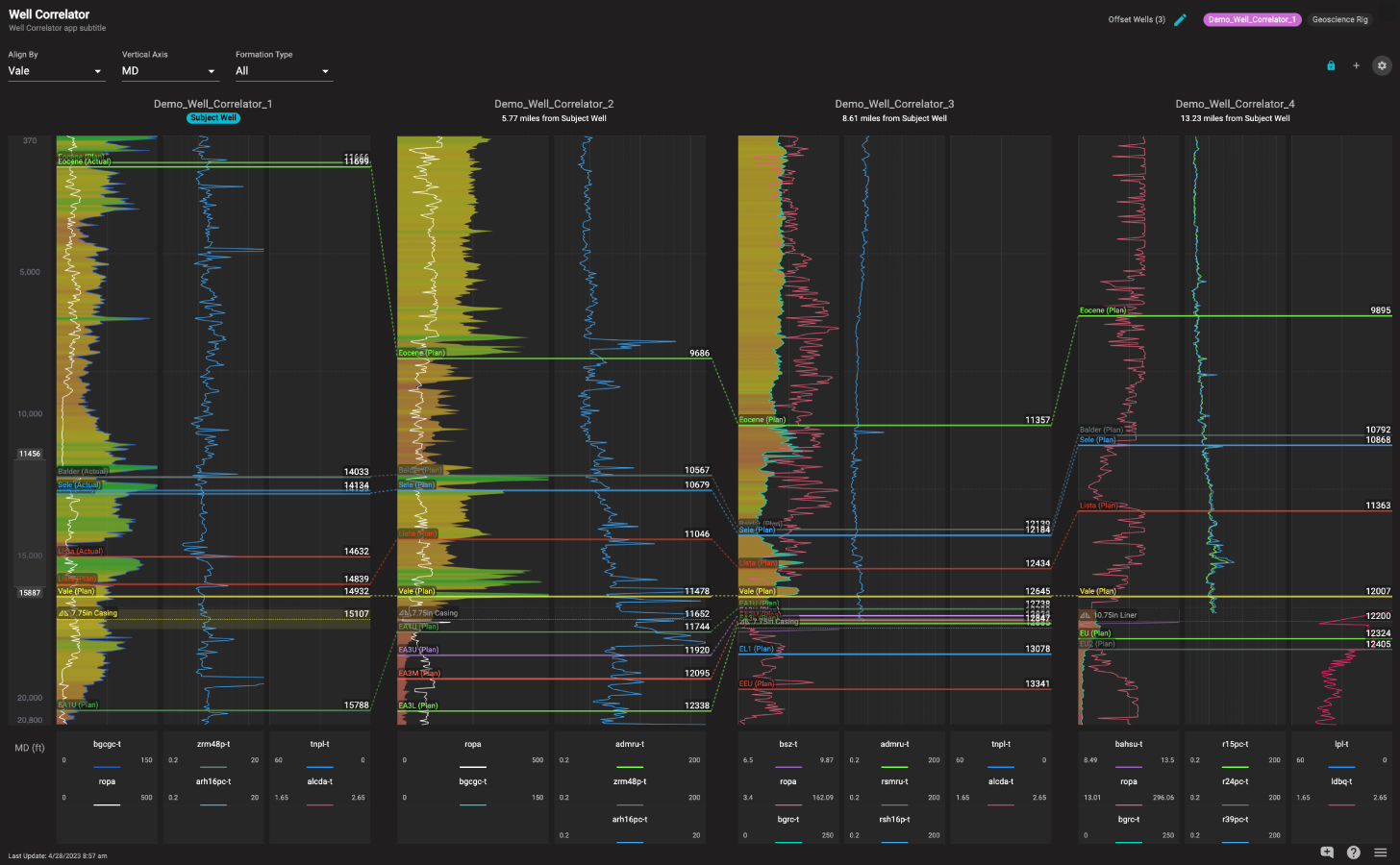
Easily correlate offset wells with log data, casing points and formation tops being drilled via measured depth, true vertical depth, or true vertical depth sub-sea. Visualize multiple wells, align by formation top or geological marker, and update formation tops to share with your team.

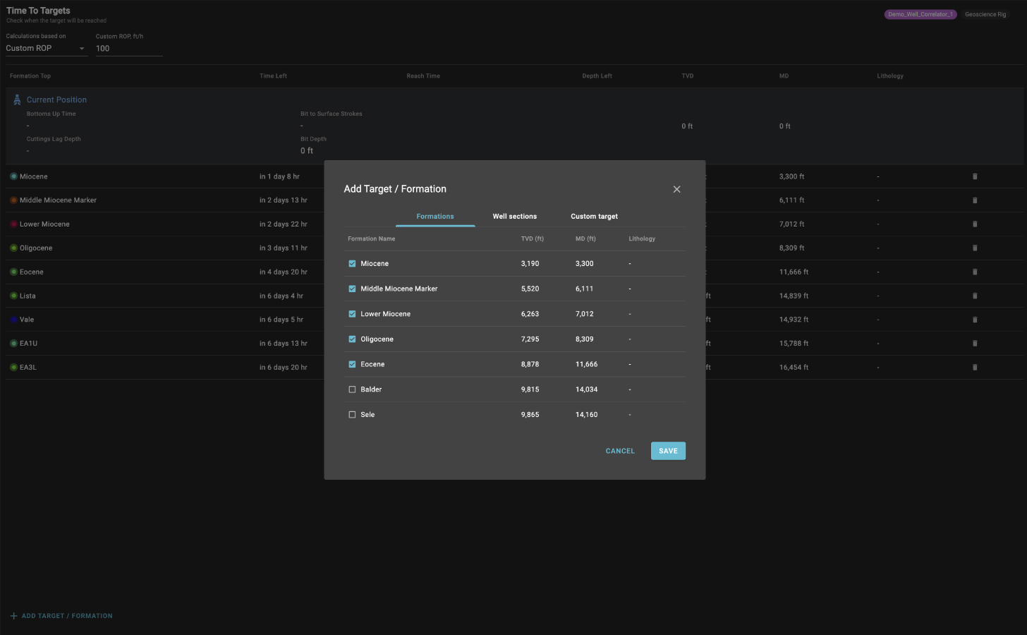
Better anticipate operations geology interactions during the drilling process by automatically calculating time remaining for the rig to reach depth targets with ROP based on average for the last 300 feet, manual ROP, or predicted ROP from Corva’s Driller’s Roadmap.

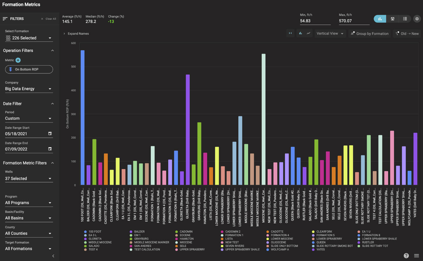
View drilling performance by formation fleetwide from 40+ metrics, including distance, ROP, rotary, slide metrics, percent in zone, and average relative dipping.

PLUG AND PLAY WITH GEOSTEERING

Expert Geological Insights at Your Fingertips

GeoDrilling tightly integrates disconnected drilling and geosteering data into the Corva platform, bringing enhanced subsurface visualization, communication, and collaboration into your workflows. Drilling teams gain instant access to the latest type logs, geological interpretations, target lines, formations, and other recommendations.

Align geoscience and engineering teams on a shared, real-time view of target zones. Instantly share target changes from geologists in the drilling mode and hand over final wellbore trajectory with geosteering notes to completions teams.

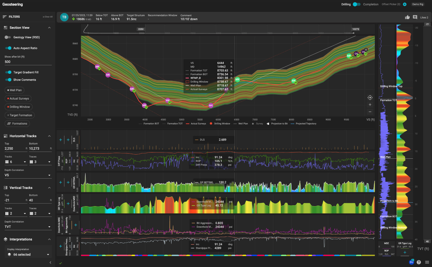
Empower directional drillers to better understand and adjust wellbore trajectory by continuously finding the sweet spot inside the drilling window, taking into account KPIs such as ROP, MSE, vibration, and footage in the zone.

SEE CORVA IN ACTION

Ready to Take Drilling to the Next Level with GeoDrilling?

Let one of our Corva GeoDrilling experts showcase how your drilling teams can adapt on the fly to updated formation tops to optimize ROP and minimize premature bit wear.